
The sprawling trail networks surrounding Kamloops allow us access to grasslands, mountain peaks, waterfalls, rock bluffs, and hoodoos whether by hiking, biking, or snowshoeing. As someone who regularly uses the recreational trail systems around Kamloops, one of the areas I find particularly interesting in archaeology is the location of ancient trail networks.
As part of the pre-field planning before undertaking an archaeological assessment, archaeologists complete a thorough review of past archaeological work conducted in the local area. This includes identifying the location of previously documented archaeological sites and any cultural heritage information provided by the local First Nations communities. This can include the location of ancient foot trails.
Unfortunately, many ancient trails are not documented. Historic maps produced by the Hudson’s Bay Company, early mining prospectors, and ethnographers can be a useful source to help identify ancient trail locations and routes. Early explorers often spent considerable effort drawing maps of the local area and the trails depicted on the maps were almost always originally established by local First Nations communities.
Besides travelling by boat through lake and river systems, travel by foot (and later horses) was the primary means to move around the landscape in the past. Trails networks were used extensively to access resource gathering locations, such as fishing, fur trapping, or berry picking areas, to interact and trade with neighbouring groups, to access important sacred and ceremonial sites, and general day to day travel throughout a region. Travel corridors generally followed a logical route over the most favourable terrain for foot travel through varying landscapes ranging from open grasslands in valley bottoms to steep mountain passes. These trail networks covered distances of thousands of kilometers.
In many cases, trees along the trails were marked in various ways in order to assist travellers with wayfinding. Blazed trees marked with axes or intentionally bent trees are sometimes found at intervals along trails in order to mark the route. The bent trees are referred to as trail marker trees with the bend in the tree indicating the direction of travel along a path or at a trail junction. Sometimes when the trail bed is overgrown from disuse and difficult to see, archaeology field crews can locate the path of a trail by following trail marker trees.
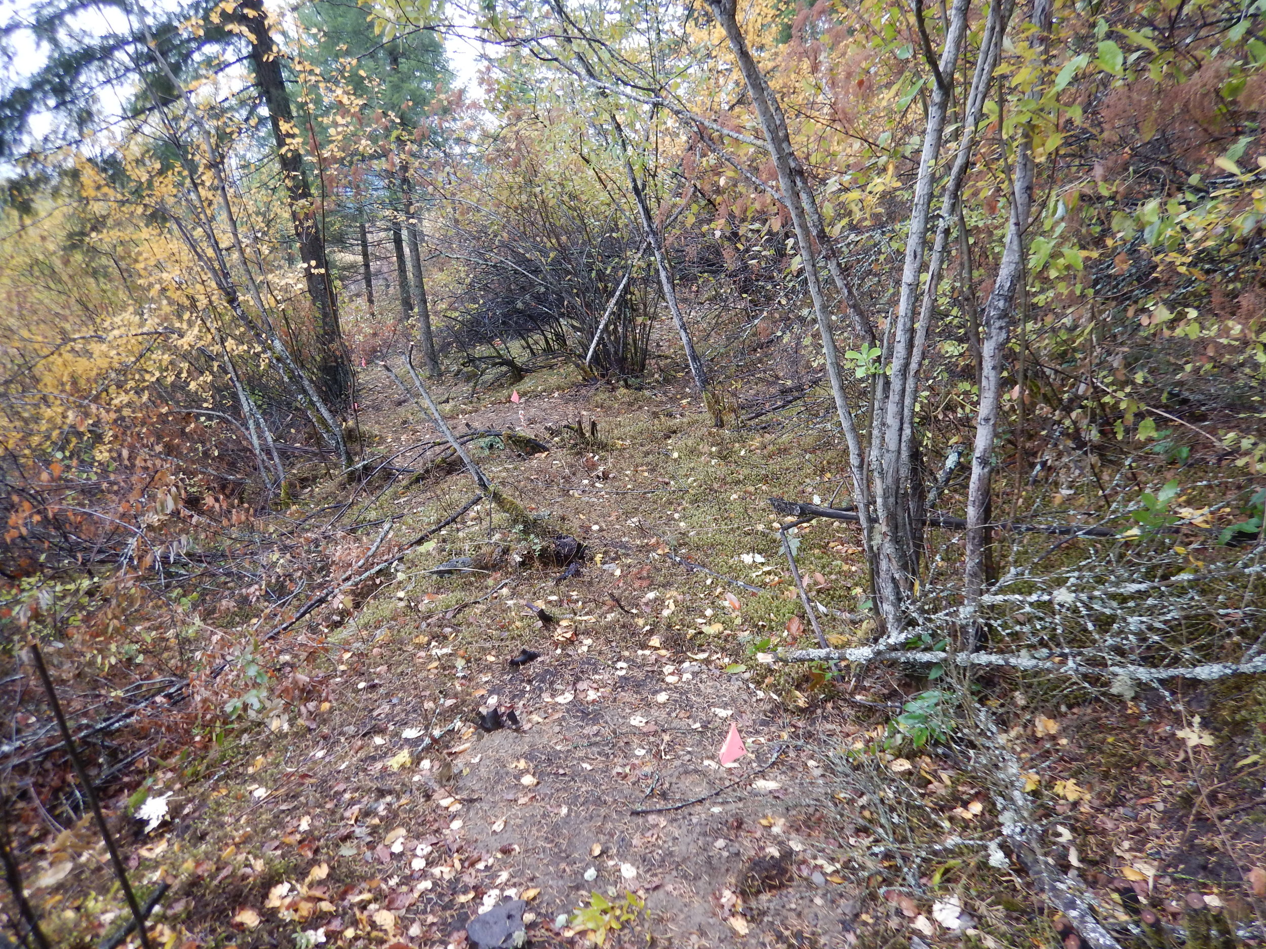
For an archaeologist, finding a segment of an ancient trail is an exciting process. If archaeology sites are found along the trail, such as stone artifacts, it further highlights the antiquity of the use of the trails. This summer, less than a hundred meters away from a major highway, the archaeology team I was working with came across a portion of a trail in a thickly shrubbed area. Once we cleared some of the brush out of the way and followed the trail, it became evident that it was an overgrown pack trail. The trail was about one metre wide and contained a well-defined and level trail bed that was cut into the side slope of the hillside. The trail followed a fairly linear path skirting above the steepest portions of the landscape. We were able to follow the trail for a few hundred meters until it was lost at the junction with the current highway. Presumably parts of the pack trail followed the same path as the current highway. We were able to locate a second portion of the same trail several hundred meters away. In total we recorded over half a kilometer of the pack trail during our study and found numerous stone artifacts in the surrounding area suggesting the trail was used many hundreds of years ago.
Unfortunately, development activities have impacted many ancient trail systems. Over the past two centuries, trails have been modified from foot paths to pack animal trails to wagon roads and eventually present-day paved highway and road systems. Although the look of the trails has changed over time, the purpose has remained unchanged – to transport people efficiently and safely across a vast province, including areas of high elevation and rugged terrain. The next time you drive through one of the many high mountain passes surrounding Kamloops, take a moment to consider the fact that for millennia people continually travelled and navigated similar routes by foot.
